The main purpose of this post is to share some photos sent to me taken by my cousin’s brother-in-law in Toowoomba. But first some context.
Paul Norton described the topography of Toowoomba thus:
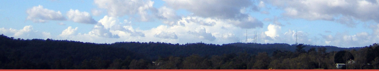
Just to give people some idea of what seems to have happened in Toowoomba, the city of Toowoomba is located just on the west side of the Great Dividing Range. As you travel from Brisbane to Toowoomba, the road begins climbing slowly after about Grantham and Helidon, then climbs steeply west of Withcott before cresting the range at a bit under 700 metres. The eastern suburbs on Toowoomba are built on the western slope of the range, whilst the CBD is located in something of a hollow at the bottom of this slope, with gentler slopes to north and south. The “cloudburst” (to used Brian’s word on the older thread) on the range looks to have basically been funnelled into the CBD by the topography.
Further to my previous comment, the range forms a neat half-circle around Toowoomba on the east side, centered on the CBD.
That half-circle, according to the Federal member for the area Ian Macfarlane, is the rim of an old volcano, which has eroded away to the west, so the main street forms a virtual gully that drains away to the plains and into the Condamine.
The cause of the floods was a sudden downpour, described on TV as “nothing much” on the radar, but delivered 150 mm (six inches on the old scale) in about half an hour. The result was like a raging gully through the CBD and a vast amount of water down into the Lockyer Valley to the east.
So here are the Toowoomba pics. The first is a long shot of Russell Street:

Here are the flood waters at the railway crossing:

Followed by another street scene:

The next is a close-up of a building in the background of the second photo. We get a view inside someone’s home:

I saw the occupant interviewed on TV. The torrent ripped away the side wall of his home exposing the inside with sagging floor.
Next we see the contents of a furniture store floating down the street:

Here’s a car wrapped around a post:

And another one somewhat the worse for wear:

That’s it folks. What we see is a raging torrent that came and went fairly quickly in a place where no-one expected to see running water.
The Toowoomba Chronicle has some photo galleries, including this one. Here’s a sample:

The Courier Mail has quite an interesting home video of the incident here.
if you are discomforted by laughter towards the end, remember people laugh for reasons other than that they think something is funny. In fact I heard an extended interview once on someone who had done research on why people laugh. “Because it’s funny” from memory amounted to some 14% or one in seven of the instances.
ABC Southern Queensland has further information. I’ll leave you with a photo from this article which illustrates how angry the water was:

Thanks for those photos, Brian. What you say, about a huge rush of water funnelled to where nobody expected/planned for it to be, is exactly what makes these photos so eerie/scary.
Hi Brian, I’m a reporter in the UK for the Indepdendent.
Any chance I could speak to you about the flooding?
My email is larisa.m.l.brown (@gmail.com)
Thanks Larisa
Thanks Brian too, for this. I’m at an IPCC meeting in Japan discussing the next impacts, vulnerability and adaptation report – everyone is aware of the SEQ floods and there have been many messages of empathy offered to thoe affected.
This La Nina is very strong according to the Bureau, and the wet began early in October and has delivered a series of strong events. The photos here speak of a relatively small event (off the radar) with great impact. So it was unpredictable, but sits within a larger phenonomenon.
Perth is gripped in record drought. Further south in the Murray Darling Basin, the long-term dry/hot conditions are likely to continue, but the clock has been re-set in terms of water storage this year.
The upper east coast of Aust has caught the last few La Ninas, and the south missed out. This year is a strong La Nina and the negative Indian Ocean Dipole has delivered wet conditions to the southeast as well. Is the heat in the atmosphere, which is involved in a more vigorous hydrological cycle, part of the current events in SEQ? Impossible to say definitively in a direct causal sense but it has a probable contributory effect.
It’s like the fires in SE Aust since 2000. People expect fires (floods) but they don’t expect them to be like this.
I like the image of the water with the billboard of the man fishing. There was a helicopter video shot of a flooded plain with the only non water thing visible being a windmill spinning furiously still pumping water. Shades of the sorcerer’s apprentice.
Thanks, tt and Roger.
Climate Progress gives it his usual comprehensive treatment and uses the Courier Mail video I linked to.
I agree with the Trenberth quote. In a sense these “cloud bursts” have been happening around the place for years, but the frequency and intensity is probably increasing. This on was quite diabolical in where it drooped its load, but would have been a whole lot worse if it had moved west a tad and more of the water that went down into the Lockyer Valley had ended up in the CBD.
See also Skeptical Science.
Larisa @ 2, I’ve emailed you.
Roger J,
The high pressure system that is causing WA’s high temps is huge and way south of Australia. It is only the skirt that is hitting Aust. But it is obviously being fed by air rising in the low pressure systems causing all of this rain. If that series of highs were over Victoria now the whole fire storm thing would be what we would be worrying about.
With water storage there are huge anomalies. For instance Oderon’s dam I was told yesterday was down to .7 metres. Oberon is in the headwater area that feeds Warragamba Dam. And there are other dams that are still very low. And whereas there has been plenty of wetness in the Blue mountains there has not been that much rainfall. I judge this by how often my swimming pool overflows, and so far not yet.
It would be interesting to know how the IPCC sees these impacts escalating, and on what time scale. The nature of these water flows I think are a pointer. With the current atmospheric water content at a 4% increase, what does it look like at 10% and with more atmospheric energy. Having seen a lot of aerial footage above the Arizona landscape it is pretty clear that water flows that even the Bible could not describe carved out that terrain. And that is innundation that will get underway at 2 deg C and above, I am guessing. How will our civilisation cope with that sort of climate intensity.
A few years ago, Debbie Abbs of CSIRO did some downscaling of greenhouse conditions over the east coast (high resolution modelling of storms). What it does in to intensify the extreme rainfalls in the areas where they already occur. This is presumably because the topography helps organise where the high-convection events happen most as the hydrological cycle intensifies.
Thanks for the photos, Brian. I wouldn’t have wanted to be there!
Thanks for the photos, Brian. Glad the only large body of water I’m looking at is the sea.
Take care everyone.
The first picture is Russell street NOT the main street!
Mr Lockhart is correct – the first photo is Russell Street, which intersects Ruthven Street (the main street) at the clock tower pictured.
@ 11 and 12, I’ve changed the post. Thankyou for the correction.
I’ve been through Toowoomba umpteen times, have visited people and places there, and a long time ago was born there, but I don’t know the CBD well. I saw the clock tower and thought, that must be Ruthven St. Clearly I was wrong.
the one where you say “resident’s home” (photo #4) is not a home…well it is his home, that room but … it’s the wall of the National Hotel, Scholefield Street, between Russell & Ruthven. Terrible what’s happened here in Toowoomba. Thanks for the article & photos.
Information was great Thanks.
Great pics and explanation, Brian – thanks!
Here is a video I posted on youtube of the water raging through Jellicoe st and washing a 3000kg shipping container away.
http://www.youtube.com/watch?v=bSlLibxCOwg
Thanks folks. Amazing what citizen’s reporting captures.
“I saw the clock tower and thought, that must be Ruthven St.”
I had to look several times to be sure. It was unbelievable and even the most recognisable landmarks suddenly weren’t.
Thanks – great article.
Great coverage. I see that someone has already identified that the ‘clock tower’ is at the corner of Ruthven St (main St)and Russell St (not city hall). It is part of the former Commonwealth Bank and as a sideline the clock hasn’t worked for years. May I comment that in the archives of the historical society or The Chronicle there would be photos of water in and up Russell St many times in the past century but never like this volume/speed. The City Council a few years ago embarked on a series of deeper channels of ‘West Creek’ through the City to alleviate the regular flooding of Dent St near the Myer and Library complexes. Obviously the deepening of the channel was insufficient in this unprecedented case.
Some backup occurs when both East and West creeks flood at the same time at their junction near Chalk drive.
And to clarify, no water from the greater Toowoomba area flows Eastwards towards any of the flooded valleys such as Murphy’s Creek, Grantham, Helidon or Withcott, Flagstone Creek.
Whilst a few houses are built on the top of the Great Dividing Range as part of East Toowoomba the water that caused the disastrous flooding to the east in the valleys was all from the Eastern side of the Great Divide – not from the flooding that occurred in Toowoomba City – it all went down Gowrie creek towards Oakey, Dalby and eventually the Condamine River.
And, it will happen again – the deep ravines down near the old bacon factory are evidence that it has happened before.
My sympathies to all those affected.
some weeks ago I saw pictures of 2 similar floods in Russell St., one in 1906 and one in 1918, but I can’t remember the website.
Thanks for comment Ted..
The Toowoomba Chronicle gave some history on Saturday 22 Jan.
It refers to Russell St flooding 1906 at almost same depth but not as fierce/fast as 2011.
The Chronicle also shows a major ice storm in Russell St 1956, as well major Flooding in the years 1860, 1864,1890, 1893, 1902,1906, 1914, 1923, 1931, 1937, 1950, 1956, 1990. All of those quotes related to significant flooding of Russell St.
So I doubt that 2011 will be the last of it – lets hope that next time is not as devasting.
gc
Speaking of chronicles … it was our first day back on Friday and we were wondering where our Teacher’s Chronicless were.
Apparently they are normally “shipped” from Toowoomba. Hmmm