All posts by Len Bahnisch

A journey of ‘Bahnisch’ family discovery in Lower Silesia, Poland

My dad’s four grandparents all came to Australia as youngsters in the 1840’s.  Three were from the Eastern European area of Lower Silesia and the fourth was from Posen Province to the north.  While this part of Europe was then part of Prussia, since WWII it has been part of Poland.  As far as I am aware, I’m only the second descendent of those four Australian migrants from our branch of the Bahnisch family in Australia to visit the villages where they were born and spent their early lives.  The only other person I know of who has done it is Noel Cameron-Baehnisch.  He made this journey in 2004 at a time when it would have been much more difficult than it is now!

At the outset, I would like to acknowledge that much of the information that has allowed me to visit these small villages was generously supplied to me by Noel.

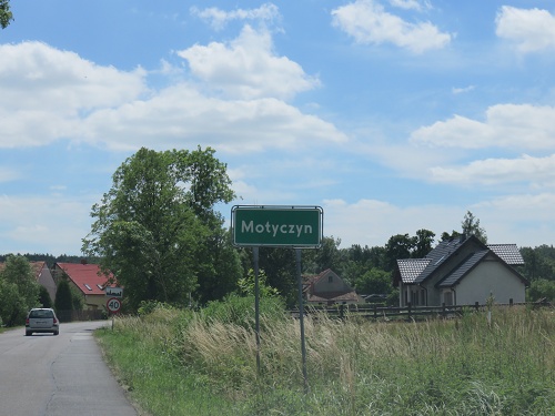
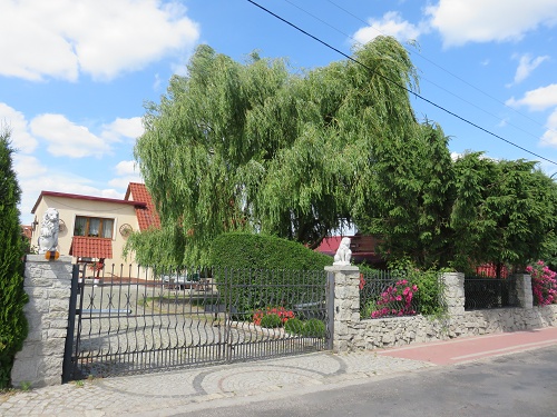
Until recently, discussion within our family had centred around the fact that ‘the Bahnisch’s came to Australia from Moettig in Lower Silesia, Prussia’.  Nothing much was known in my immediate family about my father’s mother and her parents.  So my journey of discovery to visit all four of these villages has been sweet indeed.  As you might expect, the first village I visited was Moettig.  All of the German place names were replaced with Polish equivalents after WWII, and so Moettig became Motyczyn.  So here we go!

1. Motyczyn – formerly Möttig, and home of the Bahnisch’s.

This is a very small village to the N-E of the city of Legnica and about a 1 hr drive west of Wroclaw.  In Poland, all villages and towns are announced with a sign of the type shown below.  In the right-background can be seen one of the three reasonably new houses in Motyczyn.

IMG_3559aA minor road runs through Motyczyn, and the entrance to the south is through an area of (apparently natural) forest (see below).  There are two side-roads that constitute the village.  On one of these, with only a few houses, I saw small stacks of cut logs.  Noel saw a similar scene in 2004, so maybe there is some ongoing income being derived from the forest.  IMG_3552a
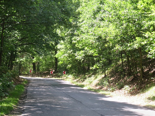
This is one of the other new houses in town – quite smart, but garden still to come! IMG_3568a
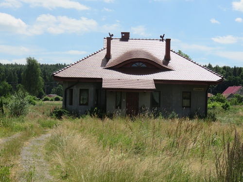
At the corner of the main side-street is a house with a (pink) sign that includes the word ‘Soltys’.  Noel says that this means ‘Village Head’.  IMG_3563a
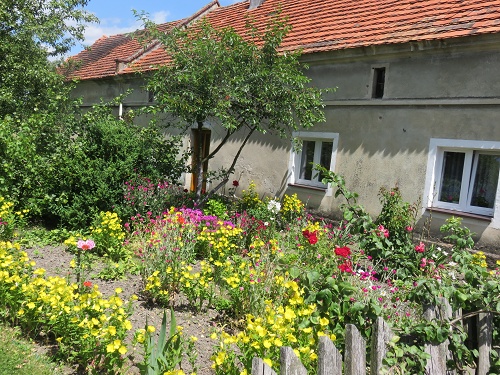
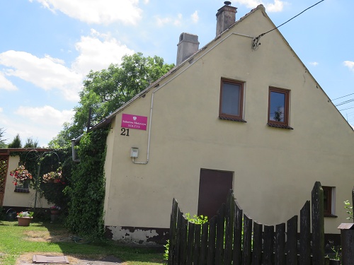
Opposite is the house with the best garden that I noticed in the village.

IMG_3564a

But apart from a few well presented houses at the far end of the main street (just before it became a track through a wheat field), my overall impression of the village was unfortunately one of despair.   Around one-quarter of the houses were no longer inhabited, and were in varying stages of dis-repair/decay.

IMG_3567a

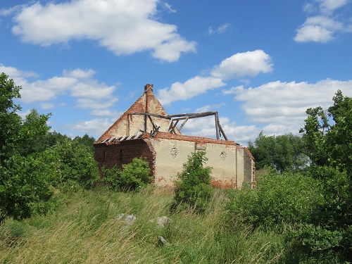
It’s interesting to think that this large, now derelict and dis-used barn may have had something to do with the Moettig Bahnisch’s!

IMG_3570aThis is the view of the main side-street from near the far end, looking back towards the road.   IMG_3578a
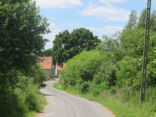
When I arrived back at the ‘main road’ corner, a couple of guys were fixing the front wheel bearings on their old tractor.  The younger chap (sitting) spoke quite good English.  He said that they have lived here for 12 years and that they have a farm of 12 acres.  When I spoke to him about my distant local family connection, unfortunately, he didn’t seem very interested.  IMG_3561a
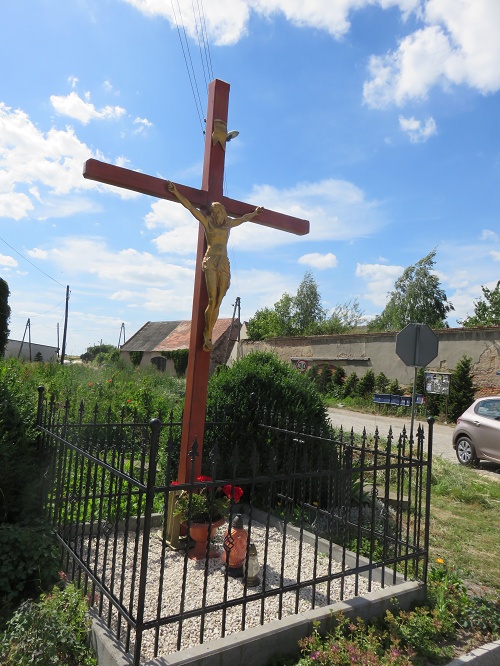
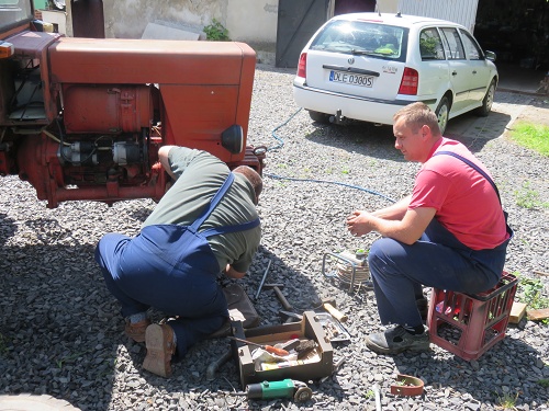
On the corner of the through-road stood a decorated cross – apparently as an after-math of local Catholic community activities during  Lent.  IMG_3562a
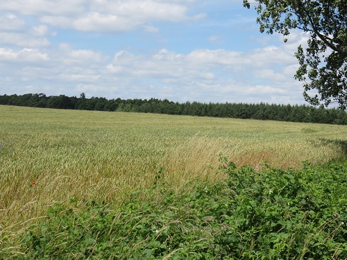
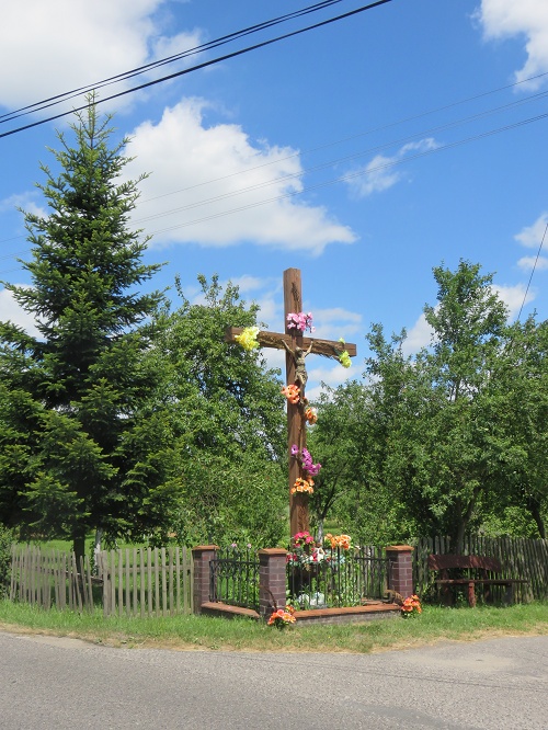
As I drove out of town, I observed that even the local crops didn’t seem to be yielding as well as many others I had seen in my travels!  But the large woodlot (in the background) seems to be doing well.


IMG_3583a

2. Dabrowka Wielkopolska, formerly Gross Dammer and home of Franziska Ruciak

Franziska was a Polish lady who married Willi Bahnisch in South Australia.  It took me nearly 4 hr to drive the back-roads directly N-E of Wroclaw to reach Franziska’s home town.  Dabrowka Wielkopolska is about a 1 hr drive due west of Poznan.  I was pleasantly surprised to find quite a large and well-presented town.

While there are at least three roads that lead into the town, this one is interesting.  While I was unsure of the meaning of the black silhouette sign in the background, Noel advises that it means ‘Place of Historical Significance’.  I noticed these signs often as I approached small villages in the rural areas of Poland.  But significantly, I think, there was no such sign on the outskirts of Motyczyn!

As well, behind this sign, you can see an area of wheat.  This crop has been planted on several vacant lots witin the town – there are houses all around it!   IMG_3802a
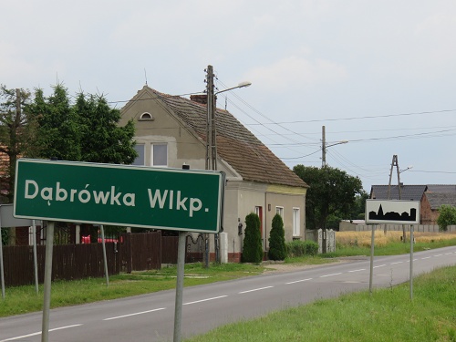
Often, villages in areas like this in Poland are only a few kilometres apart.  As well, they are sometimes connected with walking/bicycle paths as well as roads.  At the end of this path, I found a cemetery.  I scanned it for the family name Ruciak, but found none.  I did, however, find two Franziska’s!   IMG_3800a
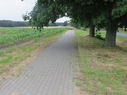
This was by far the largest of all of the villages/towns that I visited.  While there were some older homes in the town, there were none in the severe state of dis-repair that I had seen in Motyczyn.   IMG_3849a
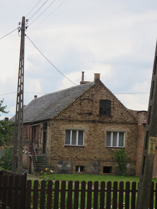
And there was a rather wonderful lake in the centre of town.   IMG_3825a
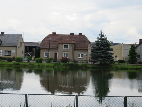
This was a rather stately home, quite close to the centre of town. It seemed to be a private residence, despite the cross on the roof.  IMG_3858a
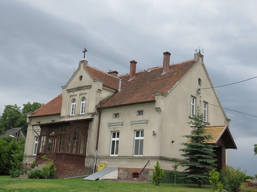
While there was little commerce to speak of in the town (apart from a couple of small convenience stores), there was an (apparently) new Catholic church with a very modern design.   Again, Noel advises that, while this church appears to be new, it is in fact old, but has had recent additions in the ‘folkloric’ style.  IMG_3829a
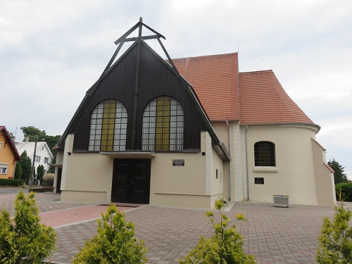
Set behind it was a large old building, clearly with religious significance.   IMG_3860a
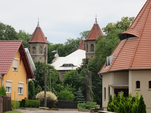
It was locked and didn’t seem to be in use.  But, based on its (former) grandeur, it had certainly been a significant building in the community in the past!IMG_3822a
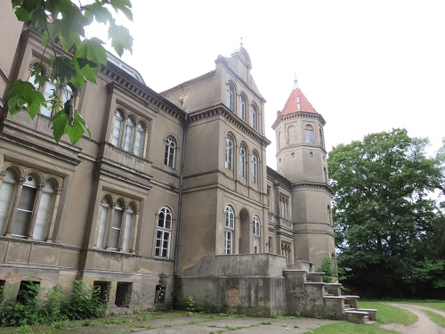
This was the only village in which I didn’t see a cross on a major street corner.  Maybe this cross next to the catholic church served the purpose?    IMG_3828a
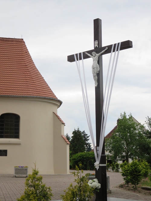
Another practice in Poland is to place signs at the end of towns leaving motorists (and cyclists and walkers) in no doubt that they are now ‘out of town’! IMG_3862a
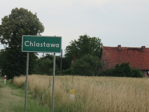
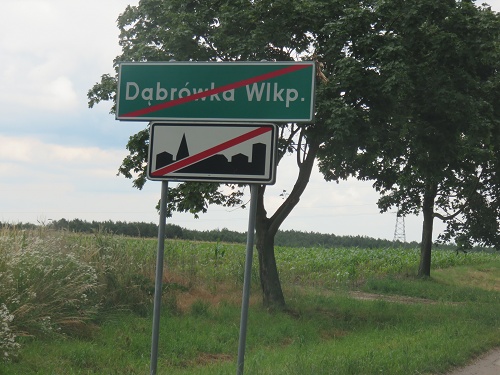
Being Polish, it would have been expected that the Ruciak’s worshipped as Catholics.  But according to Noel, this family was a little different.  Apparently, they worshipped as Protestants in the nearby tiny village of Chlastawa.  As you can imagine, I was keen to see it.  While it was 7 km away by road, in a direct line, the trip to worship for the family would have been a lot less.

IMG_3807aWhat I found right adjacent to this very small village was a total surprise.  There was a massive Ikea distribution (and maybe manufacturing) centre!   Along the building frontage, there were 23 semi-trailer loading bays.  Nearby, there was a large truck park with dozens of trucks, presumably waiting to be loaded.  And there were staff car-parks with hundreds of cars at each end of this massive building.

What an immense change to the local community/economy this business must have made.  IMG_3810a

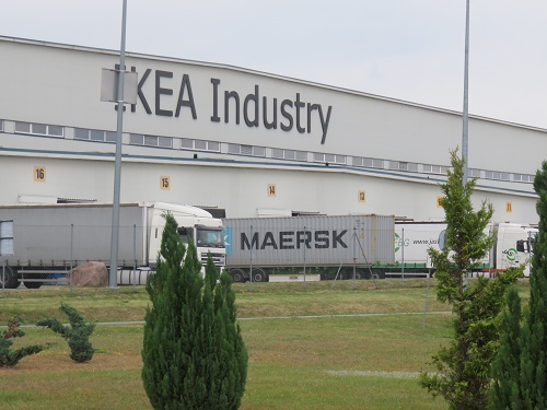
But I was looking for any evidence that there had been a protestant place of worship here in the past.  What I found was this Catholic church of wooden construction.  And as with all of the other churches I had visited during my travels in Poland, it was locked.   When Noel visited Chlastawa in 2004, he was with a Polish guide and was able to gain access to this church.  He says that it was originally a Protestant church and dates from before the mid-1800’s.  So it is likely to have been the place of worship of the Ruciak family before they migrated to Australia.  IMG_3814a

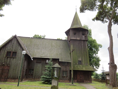
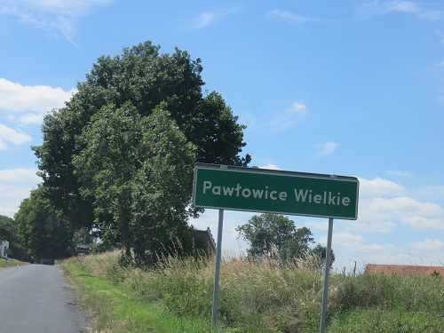
3. Pawlowice Wielke, formerly Pohlwitz bei Liegnitz and birth place of Wilhelm August Gregor, father of Louise Gregor, my father’s mother.

Pawlowice Wielke is south of Motyczyn, and only a short drive south-east of Legnica.

IMG_3584a This village was a little different from many that I saw in that it had mostly cobbled streets.  IMG_3588a
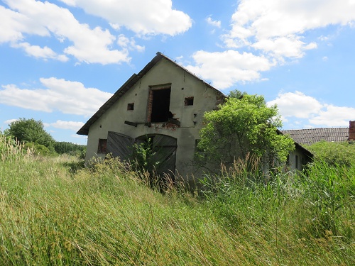
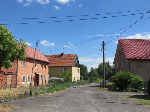
There were two very large buildings in the town, one of which had recently had a new roof installed.  The second of these buildings was currently having its roof replaced.   IMG_3586a
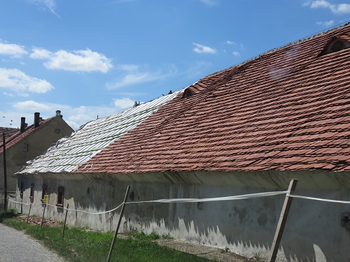
For me, the village had a very pleasant atmosphere about it, and it was a satisfying feeling to know that this was where my great grandfather, whom I had previously known nothing about, spent his younger days! IMG_3598a
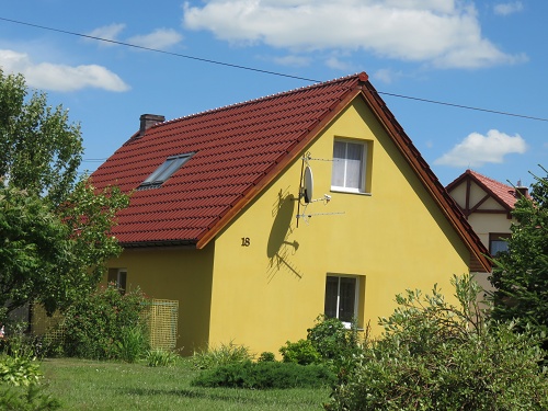
There were pleasant landscapes and extensive gardens.   IMG_3600aAs well, crops in the nearby fields were flourishing.   IMG_3601a
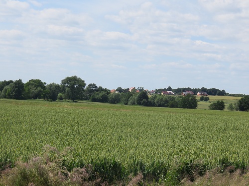
As I now expected, I found a decorated cross at one entrance to the village.  There was also a stone-fruit orchard nearby with speakers strung in the trees and pleasant music playing.  But no people!  What was that all about, I wonder?  IMG_3590a
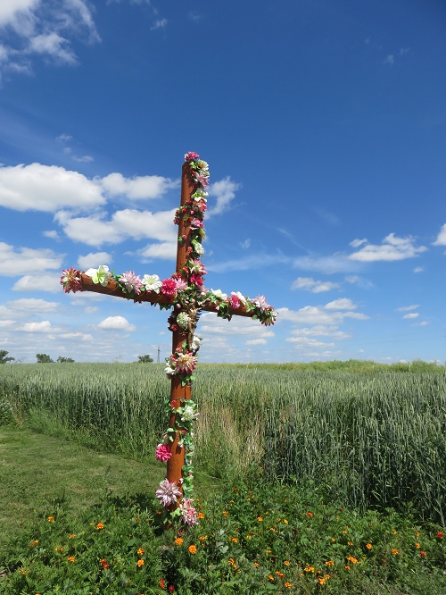
As well, there was a more permanent crypt at another entrance to the village.   IMG_3594a

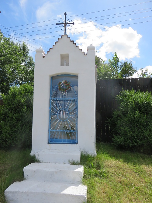
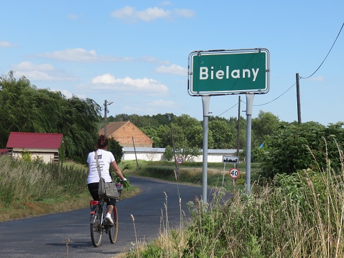
4. Bielany, formerly Weissenleipe, birth place of Ernestine Pauline Schulz, who married Wilhelm August Gregor and whose daughter, Louise was my father’s mother.

Bielany is a small village quite close to Pawlowice Wielke.

IMG_3603aIt is a village in two parts.  At the bottom end of town by the main road, there are several businesses that you would not normally expect to find ‘in town’, including a scrap metal yard.   IMG_3620a
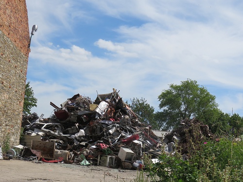
Again the main street of this small town was cobbled. IMG_3622a
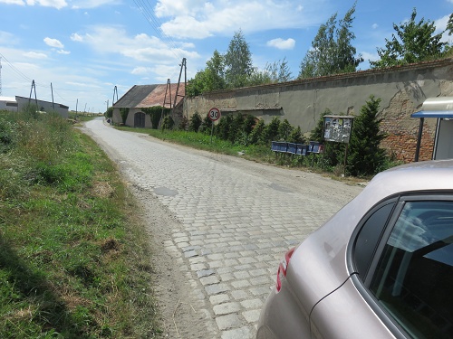
Towards the top end of town, it had an entirely different character …. a pleasant environment with well-tended homes and gardens.  IMG_3617 IMG_3611a IMG_3610aIMG_3606a
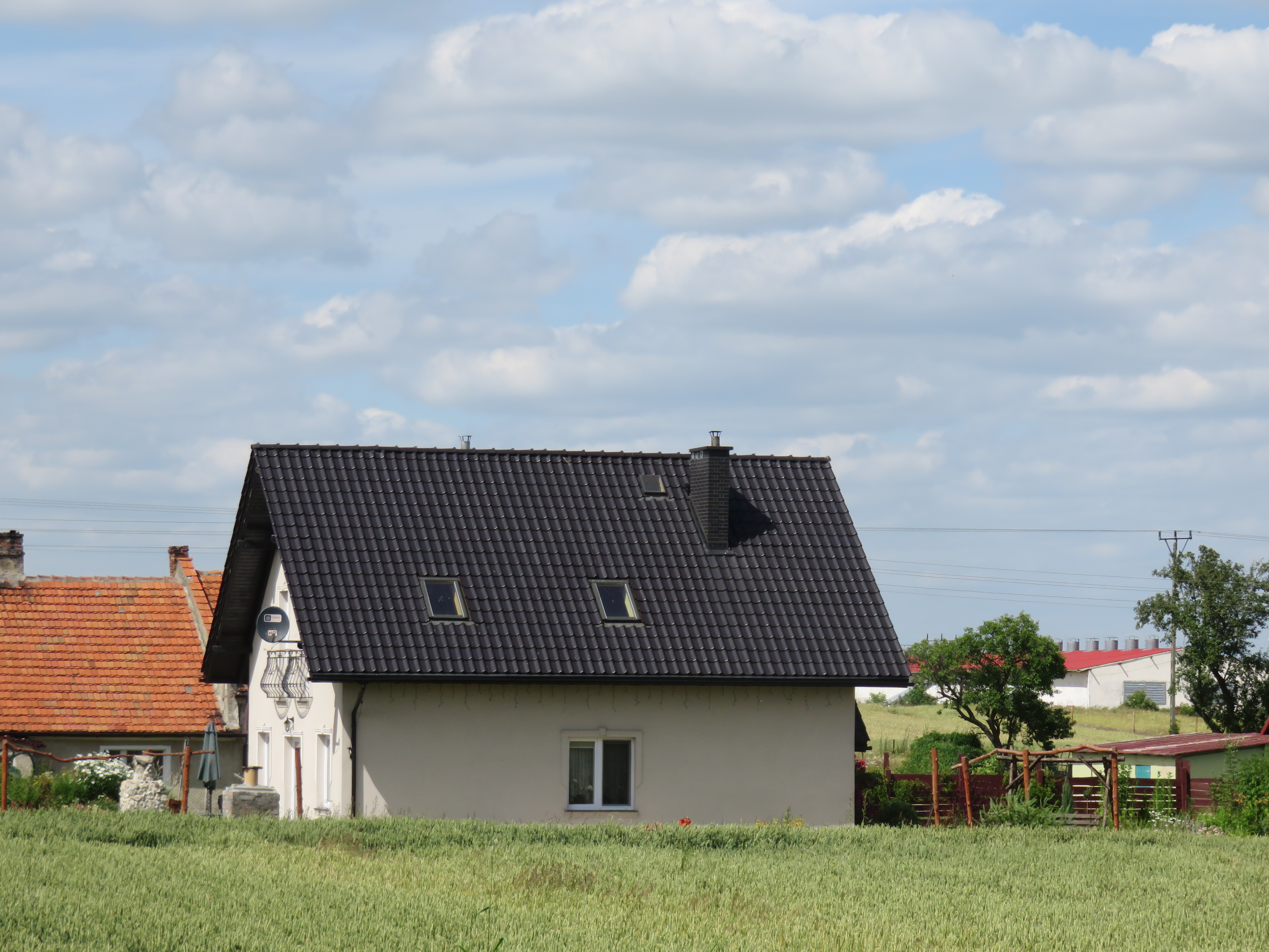
But there was very little still existing in this small town that might give a clue to the child-hood circumstances of my great grandmother.

Again, at the intersection of the village street with the ‘main’ road was the ever-present cross.

IMG_3621a

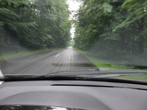
I also attempted to visit the village of Karmin where Franziska Ruciak’s mother was born.  I Googled for it and checked with my Navi system and both pointed to the same place, about 1 hr drive north of Wroclaw.  So on the way back from Dabrowka Wielkopolska, I set the up the TomTom to go there.  The drive across was mainly on very quiet and often one lane roads, with an average speed of about 60 km/hr. Lots of farming and lots of trees – both native and plantation.  And it was raining!  So this is some of what I saw:

IMG_3874aTrees in foreground below are native – in the rear they’re plantation. IMG_3870a
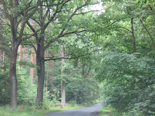
This is actually a cobbled road! IMG_3875a
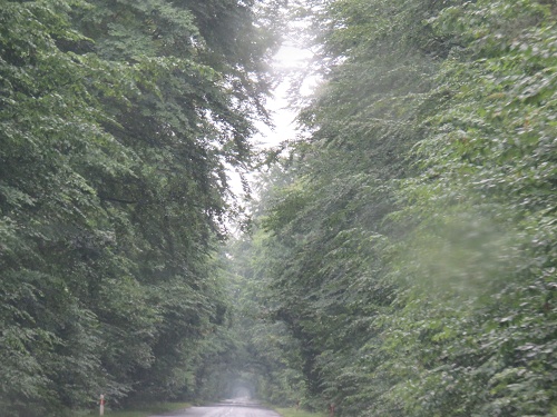
Finally, I came to where my TomTom said that I had ‘arrived at my destination’!  – see below.  Not likely!  You may be able to see a faint figure in the distance.  I hadn’t yet noticed him when I took this photograph.  But when I did, he turned out to be a burly, dishevelled looking woodsman. I must say I turned the car around and got out of there very quickly!

When I returned to my B&B, I found that Noel was indeed correct – there is more than one Karmin in Poland.  All I can confirm is that Fran’s mother wasn’t born about an hour’s drive north of Wroclaw!   IMG_3880a

It has been an emotional experience for me to have the opportunity to travel around these villages.  A lot has happened here since the mid-1800’s, so I didn’t expect to see much evidence of the folks who left for Australia.  But where are the old cemeteries of the communities who lived here then?  Noel advises that most of them were deliberately destroyed after Poland took over in 1945.  As well, across Europe, cemeteries are regularly reused by succeeding generations.

There was a lot of destruction in this area during WWII.  Maybe that explains some lack of evidence of the past?  And of course, there was the forced transmigration of most remaining Germans out of this area into East Germany after the end of WWII.  As well, I’m told that Polish people were forced out of their homes to the East of here when part of what had been Poland was incorporated into what are now the independent states of Belarus and Ukraine.

I’m pleased that the folks who left for Australia made the decision to move.  Their motivation to move was at least partly economic, seeking opportunity in a new land.  It must have been a very difficult decision for them to make.  They came to a land with a totally different natural environment and climate that would have seemed very strange to them for a long time!   But I’m very pleased and grateful that they made the bold decision to turn their lives upside down for a new life ‘down-under’!

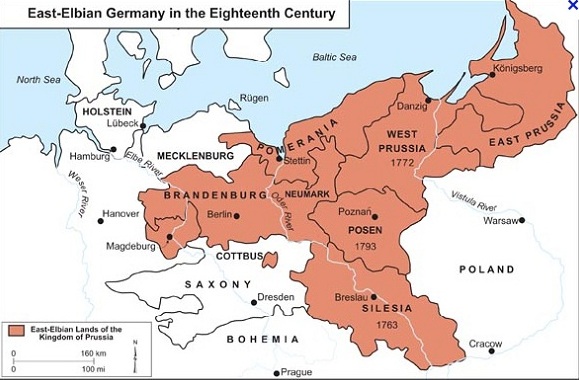
Update (Brian): This map shows the boundaries of Prussia in 1793, which on the eastern side are the same as they were in the mid-19th century:

Germany_18C_600_cropped

Möttig, near the city of Liegnitz (now Legnica) is about 70 km west of Breslau (now Wroclaw). Dabrowka Wielkopolska, formerly Gross Dammer, is west of Poznań, pretty much on a direct line between Berlin and Warsaw.

Silesia was ruled by the Austrian Habsburgs under the Bohemian Crown until 1742, when Frederick II (the Great) of Prussia snatched it from Maria Theresa, a 25 year-old woman at the time. In 1740 she had become Queen of Bohemia and in 1745 became Holy Roman Empress Consort and Queen Consort of Germany in an arrangement where she shared the imperial role with her husband in a bandaid solution when the Habsburgs ran out of male heirs. She didn’t give up easily on Silesia, but conceded in 1763 after three wars.

Silesia was about 75% German, but Lower Silesia (western, lower down the Oder River) would have been close to 100%. After WW2 Silesia was assigned to Poland. Some 5-6 million Germans left Poland mostly from Silesia and the provinces along the Baltic (Pomerania, Gdansk (Danzig) East Prussia etc). In the 2011 census only 150,000 of 38 million Polish residents identified as German. Some 60,000 speak a language known as ‘Silesian’, a Slavic language influenced by German. I assume most of them live in Silesia, which now has a population of about 5 million.

Posen became Prussian in the second partition of Poland (by Russia, Austria and Prussia) in 1793. Prussia lost it when Napoleon reorganised the map in 1807 but regained it in 1815. Posen returned to Poland when it was reconstituted as a country after WW1. Silesia at that time remained with Germany.

Posen had about 35% German speakers, mainly in the towns and towards the west.

This map shows the changes in Prussia, leading to the reunification of Germany as an empire (there were four kings in that lot) in 1871:

Germany_1815_600

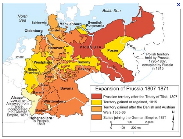
Prussia when our ancestors left Prussia comprised the reddish-brown and yellow parts. Modern Germany is limited to the Oder-Niesse line.

A Coast to Coast odyssey: Stage 3 – Ennerdale Bridge to Black Sail YHA

Our stay at the Shepherds Arms Hotel in Ennerdale Bridge was delightful.  A special highlight was barman Callum – he has an honours degree in English from Newcastle University and is now studying for his PhD.  His program involves completing a thesis during the first part of his candidature, and then writing a novel.  And his thesis topic?   –  ‘Miltonic Ideas of The Fall in the Romantic Period – 1790 to 1825’ …. or translated, ‘What they thought about Adam & Eve, the snake and the apple in Milton’s day!’.  Our friendly Soil Scientist was enthralled and seemed to engage Callum in animated conversation about his chosen topic at every opportunity!

Drying walking gear on an extended hike like this can be a problem.  Some accommodation houses have drying rooms, others have the central heating units in the rooms and still others have nothing (ie, central heating not on because it is thought to be warm enough without it (probably is, too – but doesn’t help when you are trying to dry clothes overnight)).  At the Shepherds Arms, they have a drying room, but only staff are allowed access to it …. seemed like a very strange system to us – were we that untrustworthy?   It meant that the washing that we had all done in a bath attached to my single room (remember, we were in plenty of mud on Dent Fell earlier in the day) came back the next morning in a complete jumble!  I lost an expensive pair of hiking socks as a result of this fracas.

Once we had sorted the chaos of our laundry as best we could and collected our prepared sandwich for lunch, we were off for our 14 km hike to Black Sail YHA.  Our route took us first along roads out of town, then along the banks of Ennerdale Water and finally along a local gravel road that progressively deteriorated as we approached the very isolated Black Sail YHA.  Sherpa Van, our accommodation and bag transport company of choice, would not deliver our bags to Black Sail YHA because of the poor standard of this road,  so we had to carry sufficient for two days of walking plus one overnight stay in our ‘day-packs’.  This made them just a little heavier than on the previous two days.

So we’re off and headed towards the valley at the right of this picture.

IMG_0507aOn the way out of Ennerdale Bridge, we came upon an attractive new house constructed mainly with slate.  IMG_0505aNotice the large conservatory on both levels – will be great in winter!  And the detail of the construction looked quite complicated.  IMG_0506aI have no idea how they build these walls, but they look impressive and I hope they last just as well as the old buildings with 40 to 50 cm thick walls!

Pretty soon we were out of town and heading towards the local lake (and water supply) – Ennerdale Water.

IMG_0512a

It appears that the level of the lake has only been raised a little to make it into a reliable water supply for local towns.  Apparently this ‘lake’ supplies water to around 60,000 households.  IMG_0519a

The walk along the banks of the lake was a highlight of the day, starting with a very well-made walking track.

IMG_0527a

And the sheep grazing lands on the opposite bank were a delight with their dry stone walls.  IMG_0525aPretty soon we came to a feature named (for no known reason) ‘Robin Hoods Chair’.  ‘You mean we have to go up there?’ –  Tricia seems to be saying! IMG_0534aSeems like the answer is – ‘Yes!’.

For about half a day, we walked with a chap called Richard who was doing the C2C solo.  So he was up for a chat on any topic that anyone wanted to raise – and a thoroughly pleasant fellow he was too.  He was on a much more punishing schedule than us, covering about twice the distance we did that day.   Here he is, heading up towards Robin Hoods Chair.  IMG_0535a

After this steep and rocky diversion from the water’s edge, the path started to become a little rougher – a foretaste of things to come as we continued our journey into the heart of the Lake District.

IMG_0551a IMG_0550aBut the scenery was no less spectacular!  In the middle of the picture below you can see the valley that we were headed for.  At the start of the day, some of us had been keen to take the alternative high route, via the ridge and peaks on the upper left of this photo, particularly over Red Pike, High Stile, High Crag and Hay Stacks as you move along the ridge.  As you can see, the clouds were getting low and in fact the rain started shortly before we reached the turn-off to Red Pike.  So we decided against the high route.  But Laurie was still keen, so later he took a solo side trip up to near Hay Stacks.  When he arrived later at Black Sail, he reported that there were lots of people up on the high path – seems like these Lakeland folk don’t let a little cloud and rain put them off!    IMG_0546aAs well, we were starting to see more large scree slopes, typical of true Lakeland landscapes. IMG_0542a

As we walked, we noticed dead patches in areas of sown forest.  From a distance, these appeared to be the result of fire damage.  IMG_4092aBut not so.  Further along the path, we came across a couple of explanatory boards.  IMG_0564a IMG_0565a

In summary, any trees affected by the soil bourne Phytophthora fungus will die, probably assisted by human-applied herbicide to help limit spread of the disease.  And the areas of forest lost to the disease will be re-planted in time with native species, presumably ones that are not susceptible to the fungus.

A related fungus is a significant problem in native forests in Australia.  I recall washing our boots in anti-fungal agents at the entrance to several National Parks in South-East Queensland during our training walks.

Eventually, we arrived at the top of Ennerdale Water and came across the fast-flowing River Liza.

IMG_0569a

It was interesting (and surprising to me) to see that the geological profile of the stones in the Liza was similar to that seen back on the beach at St Bees.

IMG_0557aBy now it was raining and we each had our particular array of gear to attempt to keep dry.  In my case it included a Gore-Tex and a poncho (no water-proof trousers at this stage).  This had the advantage of keeping both my pack (back) and SLR camera bag (front) safe from the weather.  Everyone else I saw on the walk preferred to use a rain-proof jacket and a pack-cover.  In fact, pack covers are not very effective if the weather turns really nasty.  And rain jackets can be far from water-proof as well.  On the other hand, I was very confident that no water was going to penetrate my plastic poncho!  So even though I looked a sight, I was very happy with my choice of gear!  IMG_0558aBy now, the valley was starting to close in and the fells above were spectacular IMG_0568aEven the rain and mist added an extra mystique to the landscape.  IMG_4090aThe gills were swollen and the green valley-sides appeared verdant.

IMG_0559a

Eventually, we came upon the delightful Black Sail YHA just in time for a late lunch – that’s it in the distance.  It was originally a shepherd’s bothy.

IMG_0579a

We enjoyed a lazy afternoon, a delightful home-cooked meal in the evening (included rhubarb pie for desert – one of my favourites!) and a surprisingly restful night in bunk beds (four to a room, men and women segregated).  But we had been warned that, while there were power points in the rooms, they conveyed no power.  Unfortunately, this advance information proved to be 100% accurate!  But this slight inconvenience was more than compensated by the charms of the delightful young Scottish lass (Alison) who was the host (and chef) at the YHA.  IMG_0603aVital stats for this stage

Distance for this stage:  14 km

Total distance covered:  41 km

Ascent:  100 m

Total ascent:  805 m

Level of difficulty:  Easy

Highlight: The delightful walk along the southern shore of Ennerdale Water


A Coast to Coast odyssey: Stage 2 – Cleator to Ennerdale Bridge

Last night we had a wonderful evening at the Jasmine Cottage B&B in Moor Row.

IMG_0343a

Our lovely host Jean couldn’t have done more to make our stay restful and enjoyable.  In the evening, she drove us to a near-by pub in Cleator for dinner and arrived exactly on-time to pick us up 2 hr later to ferry us back to the B&B.  As well, I inadvertently rushed out of the door the next morning without clearing out the hanging space in my room.  Jean kindly offered to bring my gear to our next overnight stay in Ennerdale Bridge for a small gratuity!  Thanks heaps Jean!

Our journey today took us through Cleator, then over Dent Fell and 0n to Ennerdale Bridge where we stayed at a local pub.

As we entered Cleator, we came across the local cricket club, with an excellent turf pitch and interesting covers (need them to cope with the English weather, I guess).

IMG_0354a

We were also interested to see a Royal Post van driving down very narrow lanes around Cleator, presumably to clear neighbourhood letter-boxes.  Please, no-one tell David Cameron that such inefficiency still exists!

IMG_0360aThe centre of Cleator consists of strip housing that was originally built for workers in the local mines.  Unfortunately, there’s not much that can be done to beautify them.  But outside the town centre, we were struck by the number of beautiful gardens.  Here are just a few examples:

IMG_0350a IMG_0348a IMG_0346a IMG_0345aOn the edge of town, there was an especially attractive row of gardens backing on to the local beck.

IMG_0372aMost of the small towns along the C2C route have a cooperative store that services not only the local community, but also the passing parade of C2C walkers.

IMG_0365aSo we stocked up with lunch to have along the path – in this case delicious individual quiches that were freshly baked in-store.  Visible from the same point as I took the previous photo was this …. what is it?

IMG_0366aSoon we were on our way out of town to Dent Fell.  It is the rounded rise in the background of this photograph.  Looks like easy stuff, right?  Well, we’ll see!

IMG_0368a Dent Fell is said to be a Lake District outlier – much smaller than the true fells of Lakeland … rather like a pimple on the Cumbrian coastal plain.  We were told that the ascent from this side is easy, but that the descent down the other side is much more challenging.  Can’t wait for that … it’s all been pretty tame so far!

IMG_0401aAs we climbed, we came to several ‘false tops’, only to find that the climb would go on after what we thought was the summit.  Around the lower slopes, there are extensive pine plantations.  Above, you can see reasonably mature trees on the right, a clear-felled area to the rear and some new planting on the left.  We couldn’t understand why harvesting was being done by clear-felling?  Why not selectively thin and leave the best stems to grow into large saw-logs?

So far, so good.  We had read dire warnings about deep bogs around this part of the path, but couldn’t really comprehend what thus would really be like.  I must have sensed trouble brewing because I started taking a series of photographs.

IMG_0391aAt the next step, one of our team was down …. and it was grit and mush up to the wast!  When the bog is so deep, it’s surprisingly difficult to extricate yourself from it.  You can see one of the men in our party appear from the plantation further up the track and another coming slowly to help … and with all of the hilarity, me continuing to take pictures.  It turned out to be women helping each other on this occasion!

IMG_0394aBut why wasn’t Tricia holding the other Tricia’s hand to help her up?  Because she didn’t want to be pulled over as well! There are limits, it seems.

Pretty soon we had passed all of the false tops (or so we thought) and arrived at a large cairn to mark our arrival.  The views back over the Cumbrian Plain were are simply stupendous!  About 300 degrees, with a patchwork of cultivated and grazed fields, a network of dry stone walls and both small and large villages, with characteristic sharp boundaries between agricultural areas and the towns (ie little acreage urban sprawl or ribbon development).

IMG_4053aThe sharp rise of the St Bees Headland could be seen clearly, IMG_4058aand the drop down from the headland where we left it during stage one (just before the town of Whitehaven) could be seen further to the north.   IMG_4051aThe other striking landmark from the top of Dent was the Sellafield nuclear power station.   We were told by an English C2C walker that the name of the station was changed after a significant nuclear accident several decades ago.  I have a vague recollection of the leak, but the public relations effort to rehabilitate the reputation of the station passed me by.  IMG_4067aOver a brew, we had an interesting conversation with a family group of three who were on the last leg of their east to west crossing.  They told us what a delight we were in for … some of it not easy (it’s really difficult to know what that means!), but very rewarding.  We bid them farewell as they headed off towards Cleator.  IMG_4062aIt turns out that the cairn at the top of the Dent climb is another false top.  The true top is further along, where the views are to the east.  So this was our first sighting of the Lake District and the Lakeland Fells.  And the boggy herb field in the foreground was also a pleasure.  IMG_0412aThe soil scientist in our midst was quick to notice the different parent material on the eroded path as we started to descend.  This was slate and would weather into finer material than sandstone, hence the bogs!

IMG_0416a

Our descent from Dent commenced with a sharp shower of rain (ie, everything was then slippery), and was quickly followed by a climb over a deer fence stile.  Best be careful here!  IMG_0423aThen, the descent began in earnest … Laurie about to head over the edge!

IMG_0432aWhile the path was mainly a grassy slope at this point, the gradient was steep.  Given that the horizon in the background of the photo below is horizontal, this picture gives an idea of the slope that we were walking down.  Stedman (the guide book of choice for most C2C walkers) says that this is the steepest part of the whole C2C path.  But I know that it’s not the steepest part of the whole route …. but more on that in a future post!

IMG_4069aTowards the bottom of the descent, there is an even steeper rocky and stony section – another one of our group lost their footing here, but thankfully only sustained a slightly bruised hand.

IMG_0457aAfter the rigours of Dent Fell, we followed a small stream up to its head-waters with the delightful name of Nannycatch Beck.  On the opposite side were steep pastures and occasional scree slopes.  One of the scree slopes reminded us of home!

IMG_0460aAnd even the sheep seemed to tire of the steep slopes of their pasture!

IMG_4083a

There were also rocky outcrops on the steep slope as well.  Here’s me in front of one, on the other side of the camera  (see Michael, I was there!).

IMG_0440a

For the first time, we noticed a box on the side of the road that appeared to be used in winter to hold salt for de-icing the roads (we came across many of these as we moved through Lakeland – sometimes full of rubbish!).

IMG_0474aI can imagine sections of road needing salting in the dead of winter.  But how is it applied?IMG_0476aThen, Tricia was off to find the first of many rock circles that apparently can be seen along the C2C path.

IMG_0480aWe read that his circle was constructed by a local identity several decades ago.  No antiquity here!

IMG_0485a 
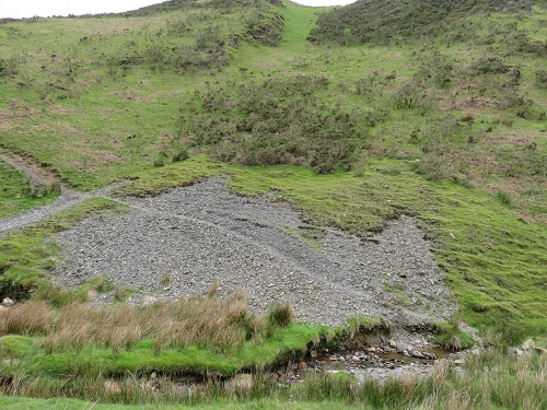
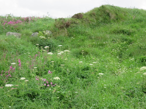
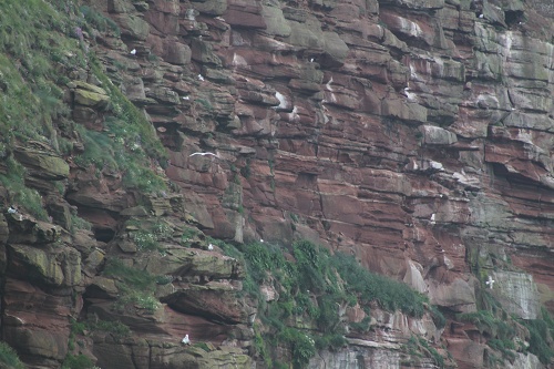
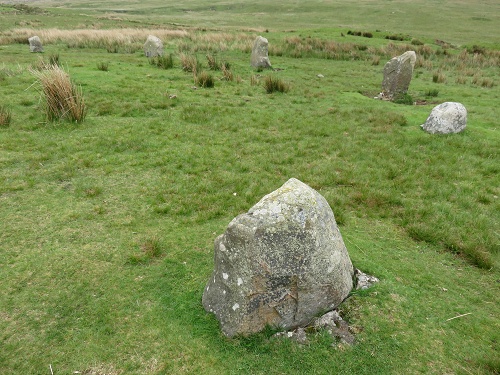
But still worth pondering the historical purpose of these circles.  Some sort of pagan ritual? Or the site of some type of community competition?  Doug (the Soil Scientist) can’t decide!  IMG_0488a

When walking through these fields, it’s easy to forget that these pastures are actively managed and that people make a living from them (or not … but that’s another story!).  Here, a farmer appears to be heading out to apply fertiliser to some pasture.  IMG_0491a

It was good to finally arrive at The Shepherd’s Arms Hotel, our accommodation for the night in Ennerdale Bridge. IMG_0500a

Vital stats for Stage 2

Distance for Stage 2:  13 km

T0tal distance:  27 km

Level of difficulty:  moderate

Highlight:  the magnificent views over the Cumbrian coastal plain from Dent Fell

Update (from Brian): To access the whole Coast to Coast odyssey series, click on Len’s name or go here.


A Coast to Coast odyssey – Stage 1: St Bees to Cleator

Our C2C journey has finally begun!  There have been times over the last 2 years when I thought this day would never arrive.  At 66 years of age, health issues are never far from your mind …. my father sadly died at this age from a ‘heart attack’.  But my cardiologist says I’m good to go!  Listen to your body, he says. ‘If you feel like you need a rest, then have one’ …. these were his parting words. Sounds like good advice for everyone to me, no matter what their age!

When I awoke at 4.00 am (all the excitement), it was raining!

IMG_0247

But the rain eased and we enjoyed a cloudy, but mainly fine day.

So we departed our St Bees B&B, fortified with a full English breakfast and made our way down to the beach where the C2C starts.  Tradition has it that, before you start, you should dip your toes (boots) in the Irish sea and select a small stone to carry to the east coast to cast into the North Sea at Robin Hoods Bay.  Well …. we’ve started what may become a new tradition.  As well as dipping our boots in the water, we selected three stones.  The first was kissed with the second and then cast into the Irish Sea.  The second was secreted in each of our packs to be carried across England and then cast into the North Sea.  This will mark the conclusion of our C2C Odyssey at Robin Hoods Bay.  And the carefully selected third stone is a keeper (don’t worry, there are tons of rocks on the beach!).  So our journey begins ….

IMG_0252Here are three members of our team completing this ritual.  Doug, the Soil Scientist in our group would have no part in it.  It’s just not right to mess with the geology of England by carrying rocks from one side of the country to the other!  And as for carrying rocks to the other side of the world!

Then it was off to have the obligatory picture taken at the official starting point for the walk (see featured image) and we were on our way.

IMG_3990First we had to make our way up to the top of the St Bees headland, an ascent of about 100 m. Then  it was time to take a last look at the lovely St Bees and we were on our way.

IMG_0264It was close to high tide when we left, so there was only a rocky shore.  But when Julia Bradbury was here filming her 6 part TV series on the C2C (as screened on SBS several years ago), the tide was out, so there were several hundred metres of sand to traverse to reach the water’s edge.  No such problems for us!

The outstanding feature of our first day was the magnificent walk along the St Bees Head cliff-top.IMG_0270IMG_0272My co-walkers were setting a brisk pace, heading towards the first inlet in the headland – Fleswick Bay.  This is an area noted for its abundant birdlife on the cliffs.  And our first glimpse of the St Bees Lighthouse can be seen in the distance.

IMG_0284The views of the cliffs are simply spectacular.  And the bird-life is a twitcher’s paradise.  I know very little about birds, but enjoyed the spectacle of it, and captured a few images as we moved along.   IMG_4000a IMG_4007a IMG_4011a IMG_4021a


At one point, just beyond Fleswick Bay, a group of seagulls were hovering in the updraft of the cliff.

IMG_4024aIMG_4025aAnd a fight broke out immediately after this photo was taken! IMG_4028a
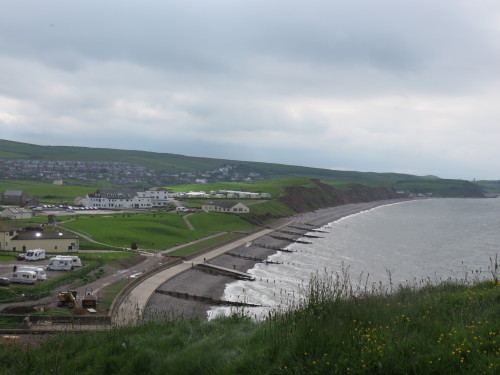
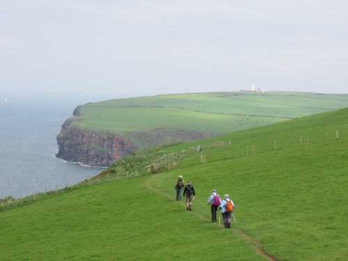
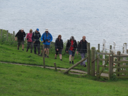
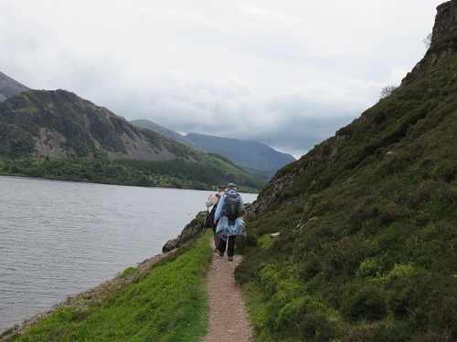
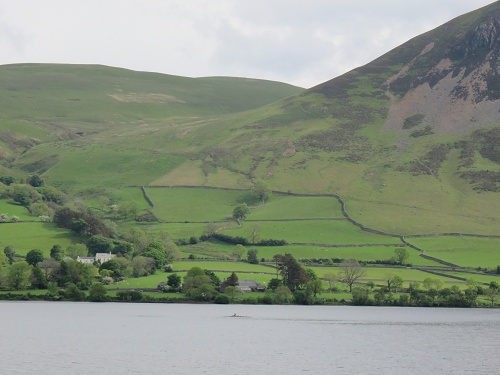
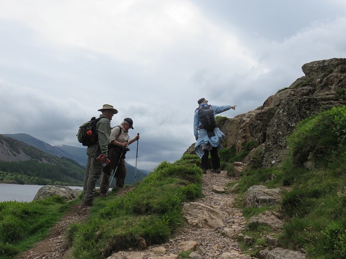
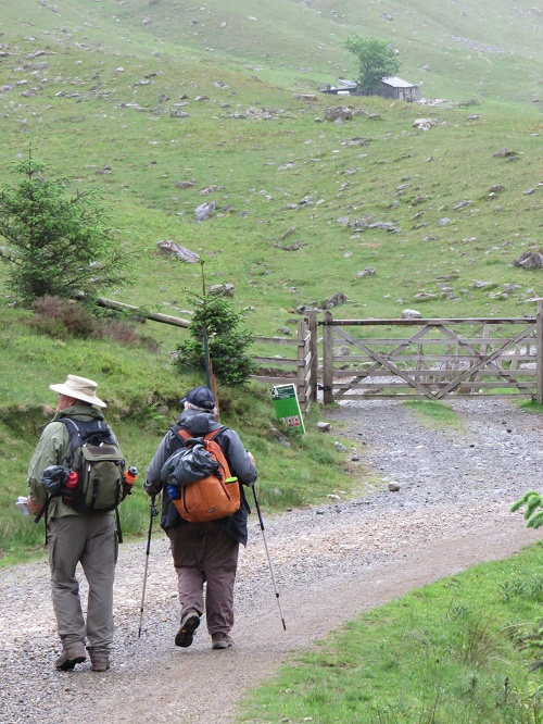
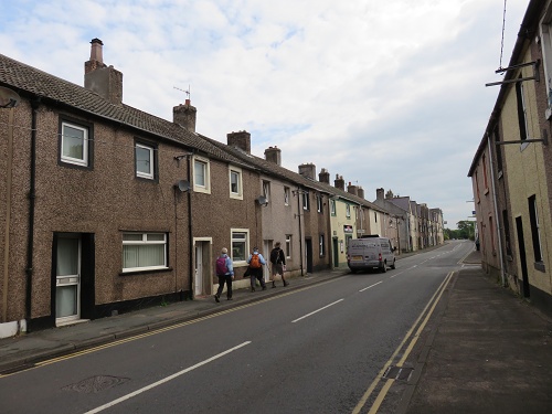
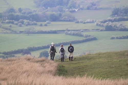
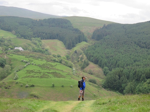
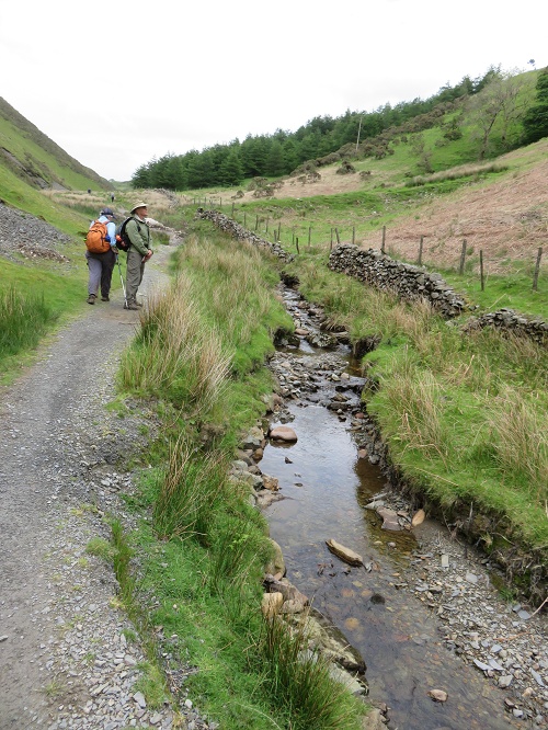
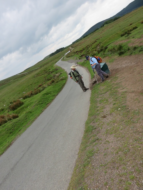
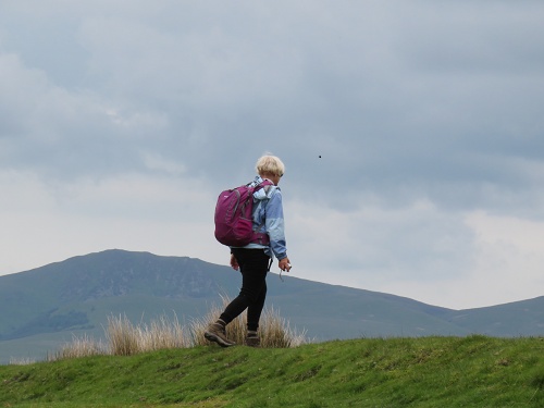
Different people walk at different speeds.  But some seem to move so quickly that it is difficult to see how they can appreciate their surroundings.  We called this group the Yorkshire fell flyers.

IMG_0293 We saw them approaching us from a distance way back behind Fleswick Bay and pretty soon they were on our tails and pressing to get past ….. in an area where the path was very close to the cliff-top and quite dangerous.  But we soon found a space to let them through.

IMG_0292The St Bees Lighthouse is interesting in that it was originally lit by burning coal.  I’ve not heard of this before, but apparently it was upgraded following many complaints from mariners about the poor quality of the light that it produced.  The facility is no longer staffed.  Sadly tours of the lighthouse that were available to C2C walkers until recently are no longer offered.

There is always a fence along the cliff-top.  Sometimes the path is on the land-ward side of the fence, as seen here.  These are predominantly sheep pastures.

IMG_0280 On other occasions, it is on the sea-ward side, and is quite dangerous in parts.  But a constant delight is the wildflowers that can be seen growing on the seaward side where they are protected from grazing.

IMG_0296 IMG_0286

In this area, the pastures are mainly grazed by sheep.  This little family seemed to be pretty content!  and there were mainly twin lambs in this area – good genetics, I think.

IMG_0276

And heading out into the Irish Sea, we saw a fishing trawler.

IMG_0288

It may well have caught our dinner …. four of us later had seafood for our evening meal in a local pub in Cleator.  In fact, Laurie declared that his Sea Bass dinner was the best meal he’d eaten since leaving home – even though he and Tricia had spent a week in Paris on the way to England!

A feature of our walking day is to boil the billy once or twice along the way.

IMG_0298We find this to be a pleasant and refreshing ritual.

IMG_0299Here, we were very close to an old quarry, the signal for us to turn east towards Robin Hoods Bay!  The C2C path then took us along some local roads as well dedicated walking paths to the small village of Sandwith (Pron: Sanith).  There was a pleasant village green and many attractive gardens.  This was a rare sighting of tulips – surprising to us given the time of year.

IMG_0303There was also quite a crowd enjoying a convivial interlude outside the local pub on their Monday Bank Holiday (what’s that all about …. we’ve had a few explanations?  But not sure?).

IMG_0305That’s our mob in the foreground having a little rest.  Definitely no ales until the walking is done!

We were soon in the small village of Moor Row, close to Cleator.  The final approach was along a very well constructed hiking and cycling path along a disused railway line.  And lots of lovely trees and shrubs along the way as well.  Should be more of them ….. nothing steep here!

We were all very pleased to see the sign for Jasmine House as our delightful overnight B&B hove into view.

Vital stats of Stage 1:

Distance – 14 km

Ascent – ca. 250 m

Level of difficulty – easy

Highlight – cliff-top walk

And finally, a note to long-suffering readers.  I’m new to blogging and so I’m learning ‘on the job’, with no-one to point me in the right direction.  Brian (my brother and the owner of this blog) kindly gave me a couple of quick lessons before I left home – without that I would have been sunk!  But you’ll be pleased to know that I am starting to swim faster!  As well, there has been no WiFi on several evenings, even in one case where the management claimed that my bedroom was the best place in the building to pick it up!  I’m also working with a notebook computer with Windows RT on it – new to me and not the best for blogging, I suspect.

So please bear with me if you wish to follow this account of our remarkable journey!  I’ll get the blogs up as quickly as I can.  But I suggest that you subscribe to this blog page – then, you will get an email when new posts appear and you’ll be able to follow our progress as I get them up!  (Too many exclamation marks, I know.  But I’m having that sort of experience.)


A Coast to Coast odyssey – where it all started

It must be around 2 years ago now that a group of four friends and I first spoke about completing the Coast to Coast (C2C) walk across northern England.  And so here we all are, eager to get going on our C2C odyssey on 26 May, 2014!

The walk starts at the small village of St Bees on the Cumbrian coast and ends at Robin Hoods Bay on the North Sea coast.  It was devised in 1971/72 by noted English fell-walker, Alfred Wainwright and the details of the walk were published in his 1973 book – A Coast to Coast Walk (a revised edition is still in print!). Since then the C2C has achieved international popularity and around 10,000 people from all parts of the world now complete it each year.  For example, we came across a chap from the USA down in the village this-morning.  He told us that he and his 78 year-old mother are starting the walk tomorrow!  We may well see them on the track. A recent survey of long-distance walkers rated the C2C as the second-best long-distance walk in the world!

But it isn’t without it’s challenges.  It is just over 300 km long (varies with the precise route taken – there are several alternatives in a number of places, frequently a high altitude option (with expansive, spectacular views) and a low altitude, more intimate parallel option).  As well, there are plenty of hills and mountains to climb, with the total ascent required over the walk around 7,000 m.  And maybe even more important, the amount of descent is the same (assuming sea-level is the same in the Irish and North seas!).

So with these challenges in mind, we decided to complete a series of one and two-day training walks around South-east Queensland (Australia – where we all live), starting about 12 months ago.  Over this period we have walked close to 200 km as a group, mostly along the excellent National Park network of walks.  These walks culminated in a 45 km 2-day trek along the ‘Border Track’ from O’Reilly’s to Binna Burra and return. Here we are at Binna Burra  about to set out on the return journey on the second day of our walk. IMG_4615a And so on Saturday, 24th May, we all converged on Manchester Airport from various parts of the world (Rome, Paris, London), meeting at the Delice de France Café, Terminal 3.  Here we are, all looking excited in anticipation of what is to come! IMG_0159 The couple on the left are Doug and Tricia Smith, while the couple on the right are Laurie and Tricia Sheahan – both have been close family friends for nearly 40 years!  While we have had many very enjoyable experiences together, this is the first time we have engaged in an activity as enterprising as this.  But I must say that our preparatory walks together have been most enjoyable.  My wife, Nola, is a great Anglophile and I’m sure would have enjoyed many things about this trip.  But  she is not a keen long distance walker  ….. so stayed at home this time.

From Manchester, we travelled by train to Barrow-in-Furness and then up the very picturesque Cumbrian coast to St Bees.

We then spent Sunday 25th May relaxing in St Bees, readying ourselves to start our great adventure.  Opposite the Fairladies Barn, our B&B accommodation in the main street of St Bees, is the little pub …. see below.  Here, we have had lashings of home-cooked fare on the last two evenings, along with a pint or two.  Roast beef and Yorkshire Pudding, meat pies (with plenty of meat), and blackberry, apple and rhubarb pie have variously kept us (too well) fed and ready to go. IMG_0245 The C2C from west to east starts on the beach at St Bees and proceeds immediately up onto the high cliffs of the St Bees Headland.  If you were sitting in the tea-house in the building on the left in the picture below, you would see us disappearing into the distance along this high cliff-top 0n the start of our journey.  After several hours we will turn inland towards the Lake District and ultimately, the North Sea coast.  We intend to travel at a leisurely pace compared with many who complete this walk.  Our plan is to spend 20 days walking (averaging 15 km/day) and have three rest days along the way.  IMG_0231We found to our surprise that the tea-house listed a slice called ‘Australian Crunch’ among its delicacies.  It must be popular since it was sold out.  So I can’t tell you what it was like.  But the ‘Bakewell Slice’ was delicious!

My plan is to make regular posts along the way.  But I can’t promise any particular frequency since it will all depend on many factors, including internet access (or lack of it) in some of the small villages.  And there may be other activities that compete for my time along the way as well!