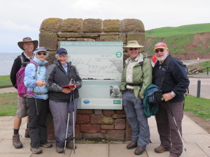
Last night we had a wonderful evening at the Jasmine Cottage B&B in Moor Row.
Our lovely host Jean couldn’t have done more to make our stay restful and enjoyable. In the evening, she drove us to a near-by pub in Cleator for dinner and arrived exactly on-time to pick us up 2 hr later to ferry us back to the B&B. As well, I inadvertently rushed out of the door the next morning without clearing out the hanging space in my room. Jean kindly offered to bring my gear to our next overnight stay in Ennerdale Bridge for a small gratuity! Thanks heaps Jean!
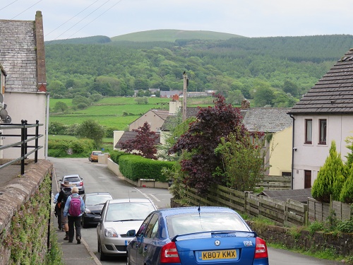
Our journey today took us through Cleator, then over Dent Fell and 0n to Ennerdale Bridge where we stayed at a local pub.
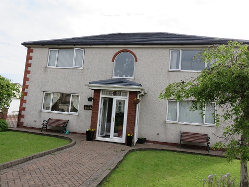
As we entered Cleator, we came across the local cricket club, with an excellent turf pitch and interesting covers (need them to cope with the English weather, I guess).
We were also interested to see a Royal Post van driving down very narrow lanes around Cleator, presumably to clear neighbourhood letter-boxes. Please, no-one tell David Cameron that such inefficiency still exists!
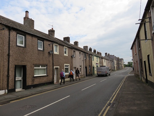 The centre of Cleator consists of strip housing that was originally built for workers in the local mines. Unfortunately, there’s not much that can be done to beautify them. But outside the town centre, we were struck by the number of beautiful gardens. Here are just a few examples:
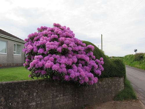
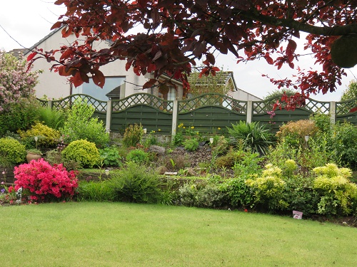
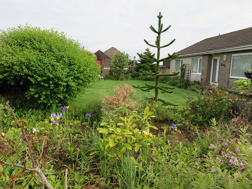
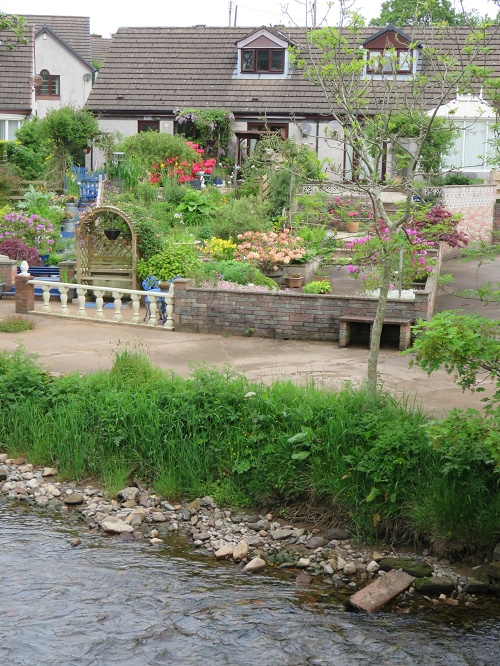
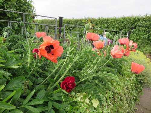 On the edge of town, there was an especially attractive row of gardens backing on to the local beck.
 Most of the small towns along the C2C route have a cooperative store that services not only the local community, but also the passing parade of C2C walkers.
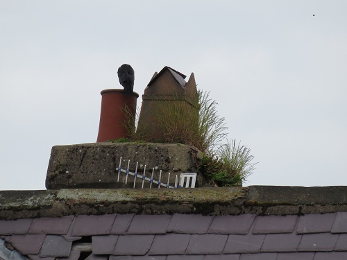
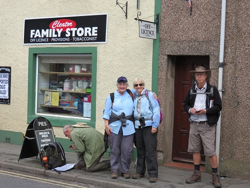 So we stocked up with lunch to have along the path – in this case delicious individual quiches that were freshly baked in-store. Visible from the same point as I took the previous photo was this …. what is it?
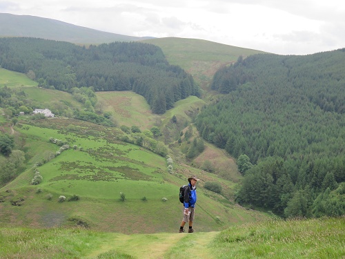
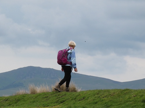
 Soon we were on our way out of town to Dent Fell. It is the rounded rise in the background of this photograph. Looks like easy stuff, right? Well, we’ll see!
 Dent Fell is said to be a Lake District outlier – much smaller than the true fells of Lakeland … rather like a pimple on the Cumbrian coastal plain. We were told that the ascent from this side is easy, but that the descent down the other side is much more challenging. Can’t wait for that … it’s all been pretty tame so far!
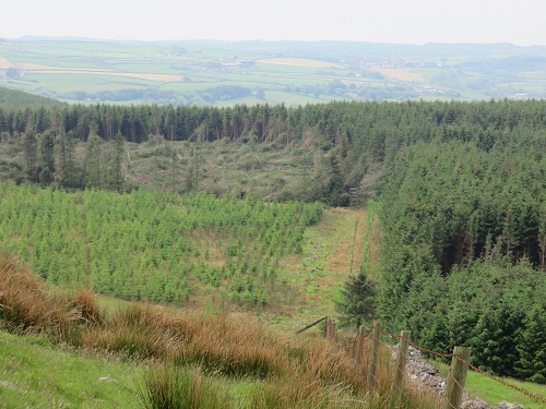 As we climbed, we came to several ‘false tops’, only to find that the climb would go on after what we thought was the summit. Around the lower slopes, there are extensive pine plantations. Above, you can see reasonably mature trees on the right, a clear-felled area to the rear and some new planting on the left. We couldn’t understand why harvesting was being done by clear-felling? Why not selectively thin and leave the best stems to grow into large saw-logs?
So far, so good. We had read dire warnings about deep bogs around this part of the path, but couldn’t really comprehend what thus would really be like. I must have sensed trouble brewing because I started taking a series of photographs.
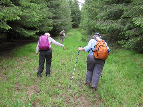 At the next step, one of our team was down …. and it was grit and mush up to the wast! When the bog is so deep, it’s surprisingly difficult to extricate yourself from it. You can see one of the men in our party appear from the plantation further up the track and another coming slowly to help … and with all of the hilarity, me continuing to take pictures. It turned out to be women helping each other on this occasion!
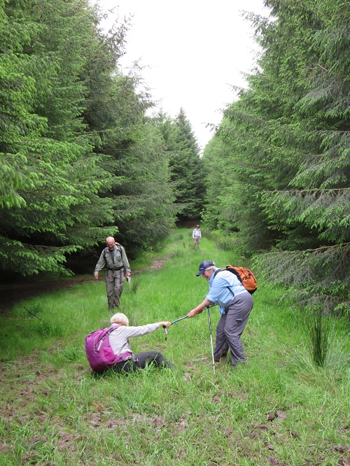 But why wasn’t Tricia holding the other Tricia’s hand to help her up? Because she didn’t want to be pulled over as well! There are limits, it seems.
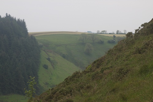
Pretty soon we had passed all of the false tops (or so we thought) and arrived at a large cairn to mark our arrival. The views back over the Cumbrian Plain were are simply stupendous! About 300 degrees, with a patchwork of cultivated and grazed fields, a network of dry stone walls and both small and large villages, with characteristic sharp boundaries between agricultural areas and the towns (ie little acreage urban sprawl or ribbon development).
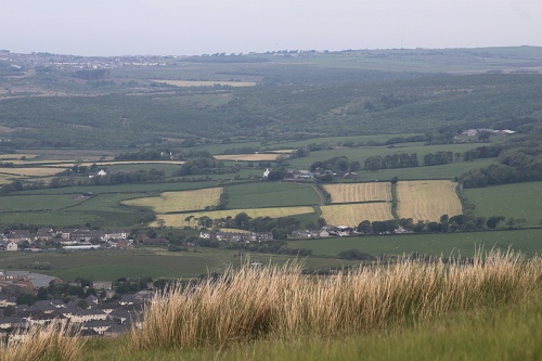 The sharp rise of the St Bees Headland could be seen clearly,
 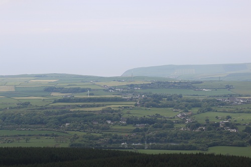 and the drop down from the headland where we left it during stage one (just before the town of Whitehaven) could be seen further to the north.
 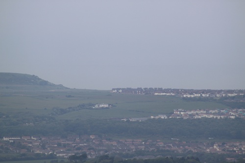 The other striking landmark from the top of Dent was the Sellafield nuclear power station. We were told by an English C2C walker that the name of the station was changed after a significant nuclear accident several decades ago. I have a vague recollection of the leak, but the public relations effort to rehabilitate the reputation of the station passed me by.
 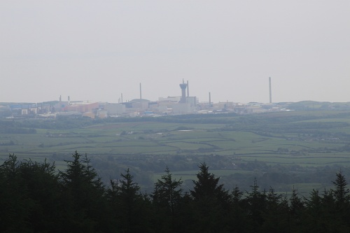 Over a brew, we had an interesting conversation with a family group of three who were on the last leg of their east to west crossing. They told us what a delight we were in for … some of it not easy (it’s really difficult to know what that means!), but very rewarding. We bid them farewell as they headed off towards Cleator.
 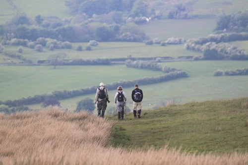 It turns out that the cairn at the top of the Dent climb is another false top. The true top is further along, where the views are to the east. So this was our first sighting of the Lake District and the Lakeland Fells. And the boggy herb field in the foreground was also a pleasure.
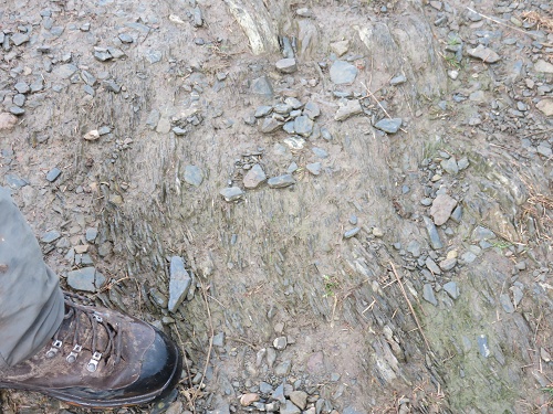
 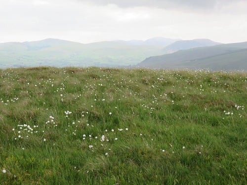 The soil scientist in our midst was quick to notice the different parent material on the eroded path as we started to descend. This was slate and would weather into finer material than sandstone, hence the bogs!
Our descent from Dent commenced with a sharp shower of rain (ie, everything was then slippery), and was quickly followed by a climb over a deer fence stile. Best be careful here! 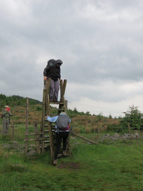 Then, the descent began in earnest … Laurie about to head over the edge!
 While the path was mainly a grassy slope at this point, the gradient was steep. Given that the horizon in the background of the photo below is horizontal, this picture gives an idea of the slope that we were walking down. Stedman (the guide book of choice for most C2C walkers) says that this is the steepest part of the whole C2C path. But I know that it’s not the steepest part of the whole route …. but more on that in a future post!
 Towards the bottom of the descent, there is an even steeper rocky and stony section – another one of our group lost their footing here, but thankfully only sustained a slightly bruised hand.
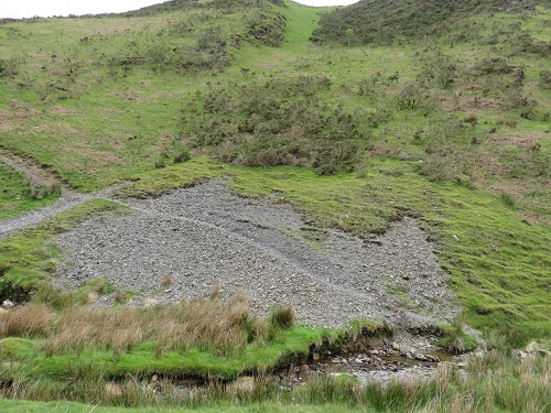
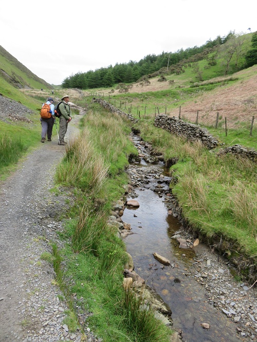 After the rigours of Dent Fell, we followed a small stream up to its head-waters with the delightful name of Nannycatch Beck. On the opposite side were steep pastures and occasional scree slopes. One of the scree slopes reminded us of home!
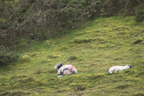
 And even the sheep seemed to tire of the steep slopes of their pasture!
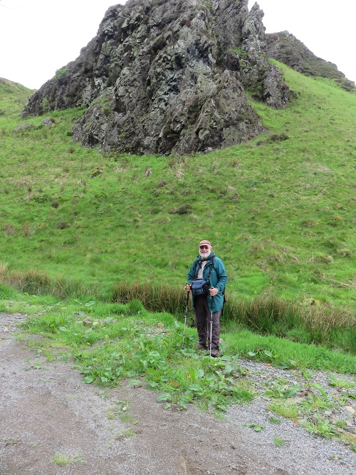
There were also rocky outcrops on the steep slope as well. Here’s me in front of one, on the other side of the camera (see Michael, I was there!).
For the first time, we noticed a box on the side of the road that appeared to be used in winter to hold salt for de-icing the roads (we came across many of these as we moved through Lakeland – sometimes full of rubbish!).
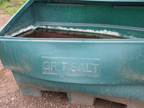 I can imagine sections of road needing salting in the dead of winter. But how is it applied?
 Then, Tricia was off to find the first of many rock circles that apparently can be seen along the C2C path.
 We read that his circle was constructed by a local identity several decades ago. No antiquity here!
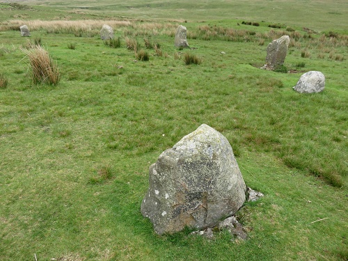 But still worth pondering the historical purpose of these circles. Some sort of pagan ritual? Or the site of some type of community competition? Doug (the Soil Scientist) can’t decide!
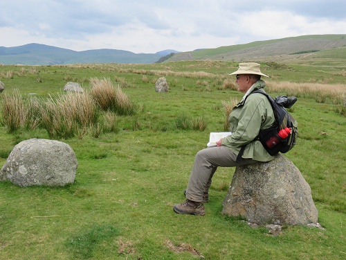
When walking through these fields, it’s easy to forget that these pastures are actively managed and that people make a living from them (or not … but that’s another story!). Here, a farmer appears to be heading out to apply fertiliser to some pasture. 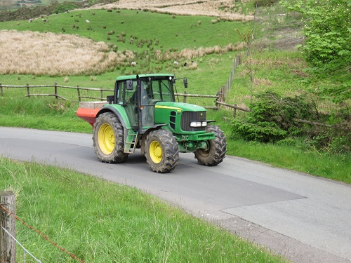
It was good to finally arrive at The Shepherd’s Arms Hotel, our accommodation for the night in Ennerdale Bridge. 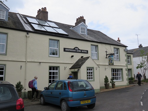
Vital stats for Stage 2
Distance for Stage 2: 13 km
T0tal distance: 27 km
Level of difficulty: moderate
Highlight: the magnificent views over the Cumbrian coastal plain from Dent Fell
Update (from Brian): To access the whole Coast to Coast odyssey series, click on Len’s name or go here.